UN
1 Pool Street
£ 142,500
Description
We don't have a Description for this property.
- Bedrooms
- 3
- Bathrooms
- 0
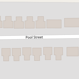


Leaflet © OpenStreetMap contributors
The heatmap indicates the level of crime in the area. The color of the heatmap indicates the crime severity and recency.
Metrics Year-on-Year
- Average area value
- 256,098.00 £Decreased by 14.07 %
- Average area rental value
- 1,156.00 £/moDecreased by 1.62 %
- Est rental Yield
- 5.42 %Increased by 14.59 %
- Crime Rate
- 59.00 %Unchanged by 0.00 %
from 298,041.00 £
from 1,175.00 £/mo
from 4.73 %
from 59.00 %
Nearby Schools
| Name | Type | Ofsted | Distance |
|---|---|---|---|
| St John'S Church Of England Primary School | Voluntary Controlled School | Good | 0.30 KM |
| Peterhouse School | Non-maintained Special School | Outstanding | 1.87 KM |
| Presfield High School And Specialist College | Community Special School | Good | 1.91 KM |
| Larkfield Primary School | Community School | Good | 1.94 KM |
| Crossens Nursery School | Local Authority Nursery School | Outstanding | 1.97 KM |
Images
Nearby Streets
| Name | Average Price | Average Sqft | Distance |
|---|---|---|---|
| Southport New Road | £ 248,120 | 0 | 0.00 KM |
Nearby Transport
| Name | NLC | TLC | Distance |
|---|---|---|---|
| Meols Cop | 2357 | MEC | 4.40 KM |
| Bescar Lane | 2351 | BES | 6.48 KM |
| Southport | 2262 | SOP | 6.86 KM |
| Lytham | 2670 | LTM | 7.64 KM |
| Birkdale | 2352 | BDL | 8.68 KM |
Nearby Listings
| Address | Price | Type | Score | Distance |
|---|---|---|---|---|
| Pool Street, Crossens, Southport, Merseyside, PR9 8HZ | £ 170,000 | BUY | 6 / 10 | 0.07 KM |
| Turnberry Way, Crossens, Southport, Merseyside, PR9 8RL | £ 210,000 | BUY | 6 / 10 | 0.14 KM |
| Turnberry Way, Southport, Merseyside. PR9 | £ 179,950 | BUY | 5 / 10 | 0.14 KM |
| Land Lane, Crossens, Southport, PR9 | £ 140,000 | BUY | 5 / 10 | 0.15 KM |
| Brookfield Close, Southport, Merseyside, PR9 | £ 235,000 | BUY | 6 / 10 | 0.16 KM |
Nearby Properties
| Address | Price | Distance |
|---|---|---|
| 70 Pool Street | £ 59,950 | 0.00 KM |
| 36 Pool Street | £ 142,500 | 0.00 KM |
| 64 Pool Street | £ 162,000 | 0.00 KM |
| 40 Pool Street | £ 149,000 | 0.00 KM |
| 52 Pool Street | £ 123,000 | 0.00 KM |